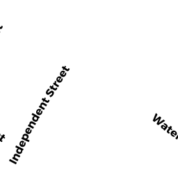
6 INDEPENDENT ST
Owner Information
SCHOONMAKER KATHLEEN
6 INDEPENDENT ST
NEWBURYPORT, MA 01950


Property Details
6 INDEPENDENT ST is classified as a Single Family Residential (Antique).
The primary structure on this property was built in 1850. There are 3,619ft2 of built area within this property. There is 1,955ft2 of residential/living space within this property. This property is listed as having 80 rooms.
6 INDEPENDENT ST is valued at $619,500. The land is valued at $203,100 and the structures are valued at $413,300. There is an additional valuation of $3,100 on this property.
This property is in Zone R3. Confirm with local Zoning Board authorities to ensure there are no overlays or other easements on this property.
The most recent deed for 6 INDEPENDENT ST is recorded at the local registrar in Book 27882, Page 391. 6 INDEPENDENT ST was last sold on Friday, June 27, 2008 for $325,000.
Assessment data from fiscal year 2021.
Flood Data
According to the FEMA National Flood Hazard Layer, this property does not appear to be in a flood zone. It may also be in an area not yet reviewed. Nonetheless, confirm this information prior to taking any action.
To view the flood hazards around this property, create a FEMA "Firmette" Map of the area around 6 INDEPENDENT ST.
Broadband Internet Providers
| Provider | Type | Bandwidth (mbps) | |
|---|---|---|---|
| GCI Communication Corp. | Satellite | 0 | 0 |
| Verizon New England Inc. | DSL | 15 | 1 |
| VSAT Systems, LLC. | Satellite | 2 | 1 |
| Viasat Inc | Satellite | 100 | 3 |
| Comcast | Cable | 1000 | 35 |
| HughesNet | Satellite | 25 | 3 |
| T-Mobile | Fixed Wireless | 25 | 3 |
Broadband service provider data from December 2020.
Adjacent Properties
- 11 FAIR ST
Single Family Residential owned by CORRIVEAU JOHN R L/I - 9 FAIR ST
Single Family Residential owned by CULLEN BARBARA - 5 FAIR ST UNIT A
CONDO MDL-05 owned by BROHEL JOHN - 5-7 FAIR ST
Other, Open Space owned by CONDO MAIN - 5 FAIR ST UNIT B
CONDO MDL-05 owned by KUHN KATHLEEN A - 7 FAIR ST UNIT A
CONDO MDL-05 owned by OBRIEN LEDOUX ARTHUR - 7 FAIR ST UNIT B
CONDO MDL-05 owned by ALVITI PHILIP RICHARD - 4 INDEPENDENT ST
Single Family Residential owned by BARTHOLOMEW CHARLES SCOTT - 8 INDEPENDENT ST
Single Family Residential owned by TYMOWSKI MIKOLAJ